On the fire line: A tour of the Falls Fire showed the power, unpredictability of a big blaze
Published 6:30 am Friday, September 27, 2024
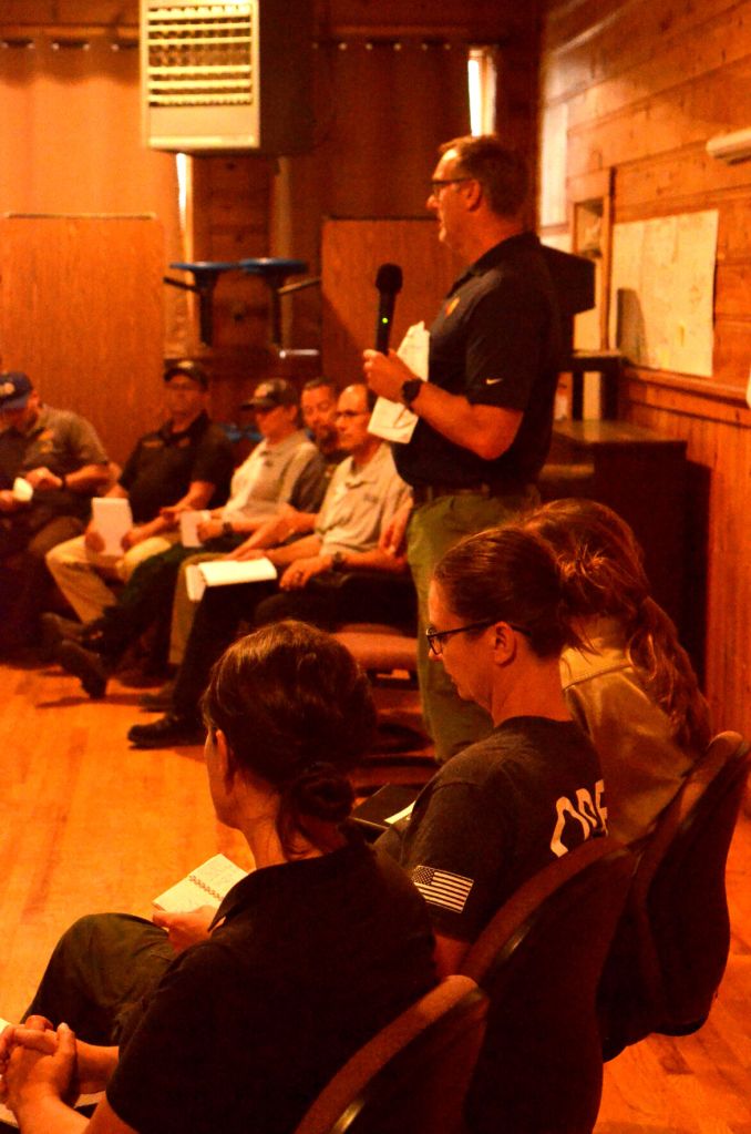
- Kevin Stock, incident commander with Northwest Team 8, briefs residents on the fire during a community meeting in Seneca on July 16, 2024.
The Falls Fire began on July 10 in the vicinity of the Falls Campground, about 25 miles northwest of Burns on the Malheur National Forest’s Emigrant Ranger District.
On July 13, the fire started out at around 5,000 acres — and then it just took off. By day’s end, the fire had grown more than tenfold, to 55,000 acres, with zero containment.
“When that happens, there’s not much you can do — the fire’s in charge,” Incident Commander Kevin Stock told a group of local residents in Seneca on the evening of Tuesday, July 16, when the blaze had grown to 91,000 acres.
“That day when the fire took its big run, the most important thing was luck — and trying to get people out of the way.”
Crossing the line
On July 16, Grant County Sheriff Todd McKinley took me on a tour of the fire zone. Driving southwest on the Izee-Paulina Highway, he pointed out some of the Grant County ranches that could be at risk if the fire spreads farther north.
He and some of his deputies had spent the past few days checking campgrounds, advising campers to leave the area and checking in with ranchers.
“We’ve got everyone evacuated (from the campgrounds),” he said. “The only people that should be out there are firefighters and landowners dealing with their own property and cattle.”
At that point, he said, ranch hands had gathered as many cattle as they could from grazing allotments in the path of the fire and put them on pastures on their home ranches. But with the fire ravaging the grazing allotments on national forest land, that meant summer forage was going up in flames.
“It’s going to put a big hurt on cattlemen in the area because they’re going to have to go to fall grass,” McKinley said.
Still, he said, things were much worse south of the county line.
“There’s whole ranches in Harney County that have burned up.”
His biggest concern was that the fire would start moving north. Turning south on Grant County Road 68, he steered his pickup toward the fire, continuing south as the road transitioned to Forest Service Road 47 and driving up to the northwest edge of the blaze.
“Right now we are just about 3½-4 miles below the county line,” he said. “Everything below here is just nuked. … This burning up here, if left unchecked, will be all up in those ranches.”
Heading north again, the sheriff turned east on FSR 3750, which runs just below the Grant County line before meeting up with FSR 37.
“This is the road I do not want to see it get past,” he said.
Noting the absence of firefighting personnel on the fire’s northern front that day, McKinley wondered why trees near the road hadn’t yet been limbed or felled.
“They could prep this whole thing, and then that becomes your containment line.”
McKinley turned northeast on FSR 37, then southeast on FSR 31, aiming to get around the fire’s eastern flank. But then, rounding a corner, his fears were realized: The fire was burning on both sides of the road.
“It has jumped the 31, right here,” McKinley said, stopping his truck. “This is going to mess up somebody’s day.”
A Forest Service vehicle with two men inside approaches McKinley’s truck, heading the other way. They stopped to talk to the sheriff and exchange information, and then one of the men got on the radio.
“He’s yelling at them on the radio,” McKinley said, returning to his vehicle, “trying to get someone up here and get this thing lined.”
Fire crews
The next stop was an old gravel quarry just west of Highway 395 near the Idlewild Campground, about 20 miles south of Seneca. It was being used as a staging area for fire crews.
There were a couple of bulldozers on flatbed trailers hitched to big trucks, some small wildland fire engines and a number of trucks and vans for transporting fire personnel. Fire crews were standing or sitting near their assigned vehicles, waiting for orders. They were wearing hard hats and yellow, fire-resistant Nomex shirts, and most of them are grimy with accumulated soot.
Derek Jensen is part of Washington Task Force 1, an 11-person team of firefighters from Thurston and Grays Harbor counties in Washington who arrived at 4:30 a.m. the previous day with four brush tenders, a water tender and a command vehicle to help fight the fire.
Their main task to that point had been clearing vegetation around buildings in the fire area as a preventive measure, but they had been forced to fall back earlier in the afternoon.
“We were up the road yesterday and today, and the fire got pretty intense,” Jensen said. “We were up there prepping structures and (the fire) started moving pretty quick, so we had to pull back.
“In about 30 minutes we go back to camp,” he added. “The night shift will come on and take over.”
Meanwhile, there was activity in another part of the staging area. A big truck had fired up its engine and had begun hauling one of the bulldozers toward where the fire had crossed the 31 road.
Community concerns
A public meeting had been called for that evening in the Seneca Community Hall. By the scheduled start time of 6:30 p.m., around 80 people had packed the sweltering room to hear an update from Stock, the incident commander of Pacific Northwest Complex Incident Management Team 8, and other fire managers.
Since the fire’s big run on July 13, he said, the team had brought in significant reinforcements and had made some headway on building containment lines and prepping structures during lulls in the fire’s growth.
“We’re up over 1,000 (firefighters), probably around 1,200 now,” he said.
“We’re much more set up to handle the size of the fire and much more set up to take advantage of those opportunities when they happen.”
After presentations from half a dozen fire managers, the floor was opened up to questions. In the audience are residents from around the area — Seneca, Bear Valley, Izee — and, not surprisingly, they had concerns.
They wanted to know where the fire was and where it might go next. They wanted to know where the firefighting crews were. They wanted to know what the team’s firefighting strategy was. They wanted to know if they and their families would be safe.
Stock did his best to allay their fears. At that moment, he told them, the fire was moving mostly south and southeast, toward Burns, which is why they hadn’t seen a lot of activity in their area.
But fires — especially big fires — can be unpredictable, he cautioned. All he and his team could do was to concentrate the resources they had where they would do the most good, and make as much headway as possible on containing the blaze.
And that, he added, is exactly what they were doing.
“I feel very good about where we’re at today — today was a good day,” he said.
“I am feeling pretty good about the plan and the resources coming in to execute the plan.”